Backcountry Development
Will Denne, Andreas Foulk, Ivan Galikeev
Signal Tracker - Track the strength of you cell signal on a map
This application provides the user with a simple and potentially life saving function, knowing your cell signal strength and most importantly where you last had a signal. Navigating the backcountry can be a very rewarding experience, however it has many inherent risks. An unprepared Jerry can easily get lost, and if that wasn't bad enough he could also injure himself and have no way to contact help.
Or app seeks to solve this problem by providing the user with information on where they can contact help. It does this by measuring the user's cell signal every few seconds and plotting that data on a map. This is shown in the image below.
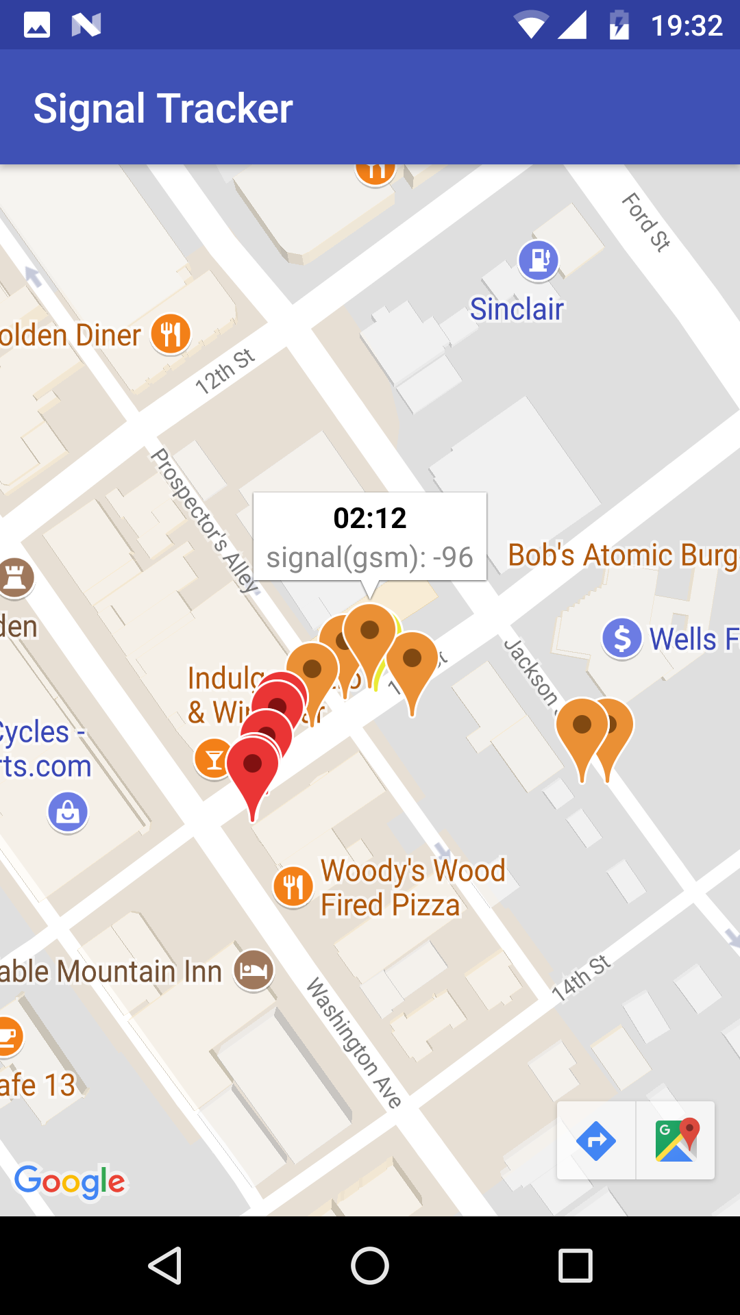
Signal strength is clearly seen by the color of the marker. A green marker would indicate near perfect cell signal while a red marker indicates no signal. Over the course of a long trek through the backcountry it would be easy for a user to retrace their path and determine where they could connect to their network.
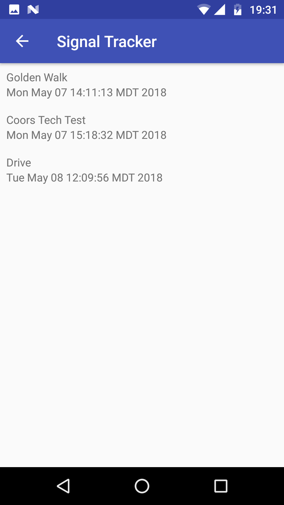
Our application also stores all previous trips allowing a user to revisit any trip. To see detailed information on a previous trip the user can tap on any trip from this list.
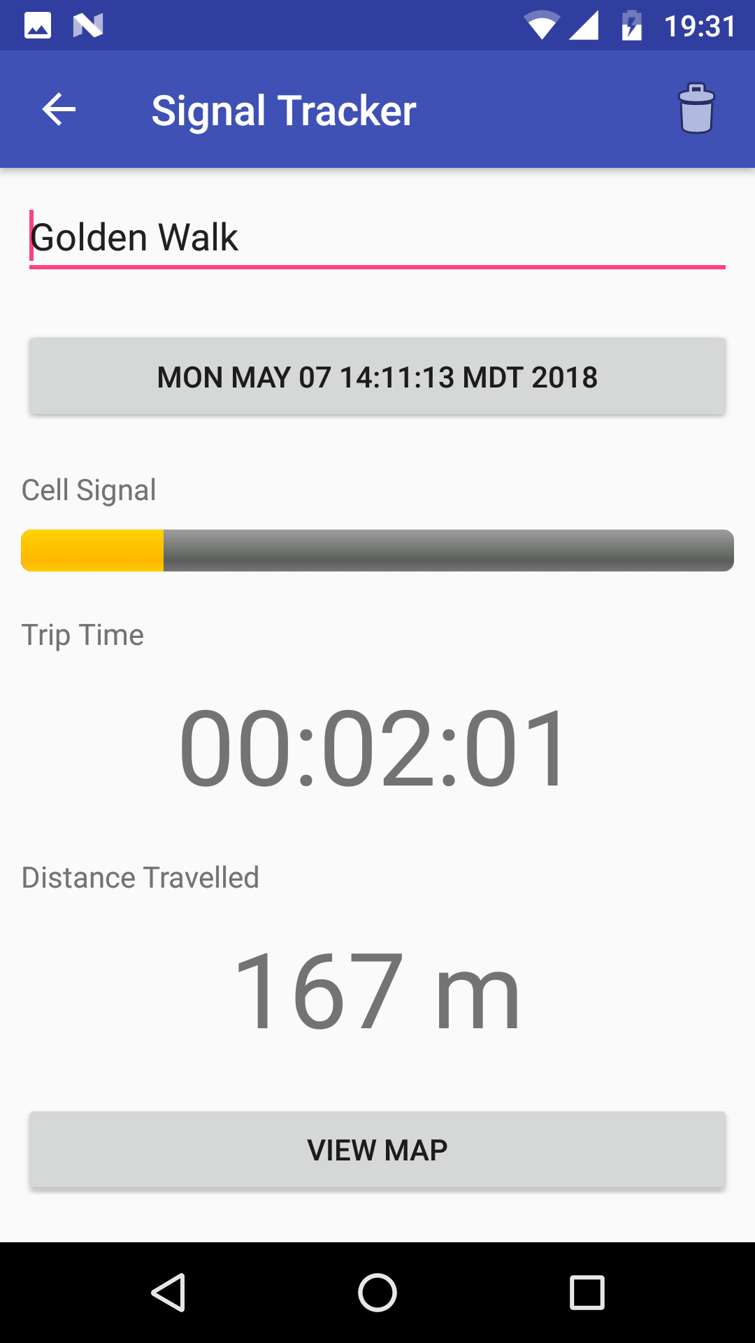
From this screen the user can update the trip name as well as view collected information on the trip including an overall signal strength rating. A user can select to view the trip map and see all the individual markers on the map. This can be used for trip planning and sharing signal information.
If you want a simple solution to staying safe in the backcountry consider downloading our app. Don't be a Jerry, be smart with your backcountry travel and always have a backup plan. Knowing where you can and can't connect help can be invaluable information. Use our app to stay connected and safe.
|